Distance: 1.6 Miles


About
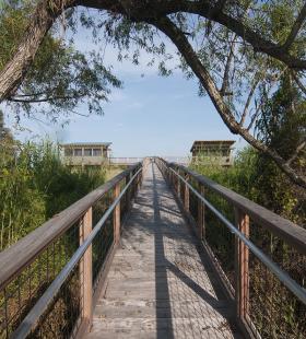
The Justins Bay shelters include two camping shelters connected by an ADA accessible boardwalk and an ADA accessible kayak/canoe launch. Access to the shelters is available through a narrow slough on the southern end of Justins Bay. The shelters face in opposite directions and overlook Justins Bay to the East and the Apalachee River to the West. These shelters also provide stairway access to the uplands where camping fires are allowed within the existing fire rings. The shelter includes a fixed dock for loading and unloading, a cooking table, benches, eye hooks for hammocks, and a curtained privacy area located in the corner of the shelter.
Camping Shelter Use Rules:
◦When camping in shelters group size is limited to 8.
◦Pets are not allowed in Shelters.
◦No open fires within 20ft of shelters. Cooking stoves (propane only) are allowed on shelter porches.
◦No cutting of trees or brush for firewood.
◦Each party is required to have a compass, map, flashlight, and portable toilet with disposable bags.
◦Shelters can be reserved for only one night. A group can reserve shelters at different locations when taking multiple night trips. Reservations are from 12 noon to 12 noon the following day. Must have a copy of shelter reservation on person.
◦Feeding or harassing of wildlife is prohibited. Do not discard garbage or food scraps on or near shelters.
◦Shelters will be inspected after each use. Damage to the shelters will be assessed and be the responsibility of the user.
◦Visitors may be held financially responsible for unnecessary rescues.
◦No alcohol allowed.
Habitats
Brackish marsh influenced by river flows from the north and by tides from Mobile Bay to the south. Except for occasional cypress stands, this area is largely without tall trees. Expansive marshes shelter a great number of species of fish, crustaceans, marsh and wading birds, flood-tolerant mammals, reptiles, etc. Please beware of Alligators as they are known to inhabit this area.
Starting Point
Ending Point
Type of trail
River Channel, Narrow Slough, Marsh Channels
Recommended Water Levels
Water levels at the Justins Bay camping shelters can drop considerably in the winter months making it difficult to navigate the narrow slough. Please check the water level at the landing to ensure the water level is adequate. High water is typically not an issue at this location since the Justins Bay camping shelters are built on high ground, but please be sure to check water levels prior to departure. Claiborne Dam river stages ranging from 6 to 19 feet on tailrace reading provide optimum water levels for this route. River stages above these values should be considered hazardous. For water level information at Claiborne Dam, call 1-888-771-4601 or visit https://waterdata.usgs.gov/al/nwis/uv?site_no=02428401