Distance: 10.2 miles (additional miles possible via adjacent sloughs and creeks)


About
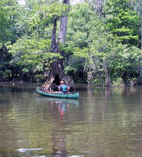
The Douglas Lake day trail begins at Upper Bryant’s Landing, located north of Stockton, AL on Baldwin County road 21. The map shows the trail leaving Upper Bryant’s Landing proceeding upstream on Tensaw Lake, into Douglas Lake to the end of the channel. The return leg follows the same route. Paddlers have several options for selecting the length and duration of this day-trip.
Habitats
bottomland hardwood swamp, flowing creeks, side channel sloughs and backwaters
Starting Point
Ending Point
Type of trail
Creek, Lake, and Slough
Recommended Water Levels
Claiborne Dam river stages ranging from 6 to 19 feet on tailrace reading provide optimum water levels for this route. River stages above these values should be considered hazardous. For water level information at Claiborne Dam, call 1-888-771-4601 or visit https://waterdata.usgs.gov/al/nwis/uv?site_no=02428401