Distance: 14.1 miles


About
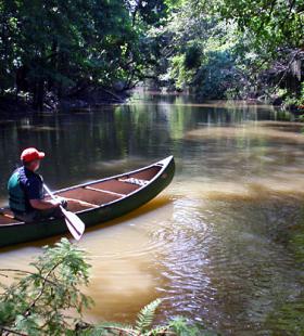
The Overnight Route # 1 begins at Rice Creek Landing, located on the Forever Wild Land Trust’s Delta Tract, 2.9 miles north of the Highway 225/59 split in Stockton, AL, on Baldwin County Rd. 21. The map shows the trail proceeding out of Rice Creek, up Tensaw Lake to Bayou Tallapoosa, through Bayou Tallapoosa to Tensaw River, down the Tensaw River to Two Rivers Point land based campsite. On day two the trail proceeds down the Tensaw River to Bottle Creek, down Bottle Creek to Bayou Jessamine, and then through this bayou to Tensaw Lake and back to Rice Creek Landing.
Paddlers should note that Two-Rivers campsite ia a first come, first serve land based campsite. The area is large enough to handle several tents.
Habitats
bottomland hardwood swamp, flowing creeks, side channel sloughs and backwaters
Starting Point
Ending Point
Campsites
Two Rivers Point
Type of trail
Old River Channel, Creek, Lake, and Slough
Recommended Water Levels
Claiborne Dam river stages ranging from 10 to 19 feet on tailrace readings provide optimum water levels for this route. Levels from 15-18 are the absolute best for the Globe and Bear Creek systems. For water level information at Claiborne Dam, call 1-888-771-4601 or visit https://waterdata.usgs.gov/al/nwis/uv?site_no=02428401